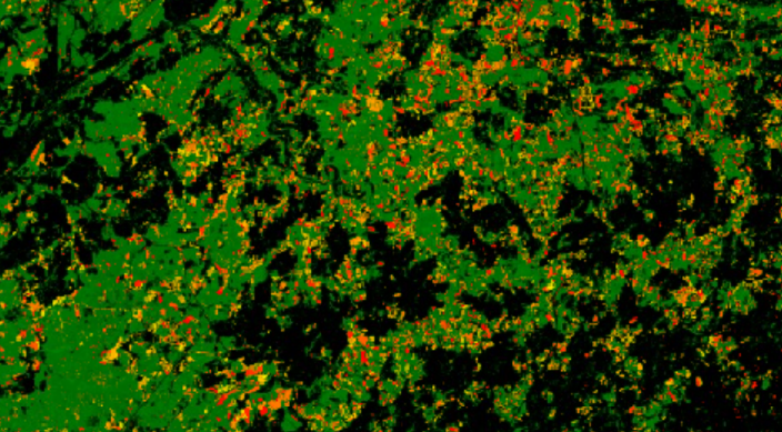
Digital Dryads’ application aims to protect forests from illegal deforestation by combining aerial and multi spectral satellite imagery. The map on the application shows pixels that are forest in green. Everything that is not forest is black. Moreover, the application enables you to see parts of the forest that are allowed to be cut (yellow) and parts that have been recently cut (red). It also shows whether the forest is protected (quasi virgin, virgin or UNESCO), making it easy to spot whether the forest was legally cut or not.
Use case - Digital forest dryads.pdf
(151.64 KB)
Country
Romania
Publication Date
Nature
Anwendung
Region
Osteuropa
Sector
Agrarwirtschaft, Fischerei, Wald & Lebensmittel
Type of Use Case
Wiederverwendung
